

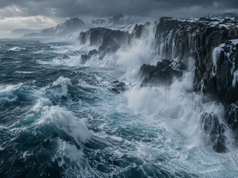
The national weather service has issued an orange warning for a storm surge along the entire coast, with water levels in Port Alden expected to rise up to 1.3 meters above a normal high tide over the next two days.
A deep low-pressure system moving in from the sea will bring gale-force winds, heavy rain and waves of up to seven meters offshore. Forecasters say the most dangerous moment will come when the strongest winds coincide with high tide on Wednesday morning.
The next 48 hours
- Tonight: winds strengthen from the west, with gusts of up to 90 kilometers an hour on exposed headlands. Rain spreads inland.
- Wednesday morning: the peak of the storm. The surge is expected to reach its highest level around the morning high tide, with waves breaking over sea walls in low-lying areas.
- Wednesday afternoon and evening: winds stay strong but slowly ease. A second, smaller peak is possible at the evening high tide.
- Thursday: conditions gradually improve, though a heavy swell will keep pounding the cliffs.
The combination of wind direction and high tide is what worries us. Even well-protected harbors can see water in the streets.
Erik Sandvik, duty forecaster at the national weather service
Ferries, roads and schools
All ferry services from Port Alden are suspended until at least Thursday morning. The harbor authority has ordered small boats to be secured or moved, and the seafront road in the old town will close from 10 p.m. tonight.
Schools in the lowest-lying parts of the Coastal Region will stay closed on Wednesday, and trains on the coastal line will run at reduced speed.
How to stay safe
Emergency services urge residents to stay away from cliffs, piers and sea walls, which can be swept by unexpectedly large waves.
Every storm, people go to the cliffs for photos. A single wave is enough to knock you off your feet. Please stay back.
Mirjana Holt, head of civil protection for the Coastal Region
People living near the shore should move valuables and cars to higher ground, keep a charged phone and a flashlight at hand, and follow updates from local authorities. Sandbags are available free of charge at three fire stations in Port Alden.
The weather service will update its warning every six hours.






Comments 0